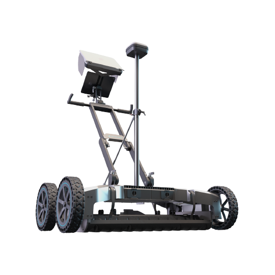
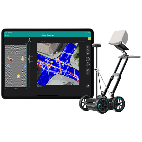
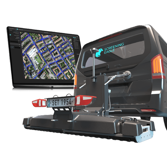
The most efficient multichannel GPR system with real-time 3D visualization
- Interchangeable GPR arrays covering a vast array of applications
- Get an accurate 3D map of the underground, literally, as you walk
- Get the most powerful insights from your data, anytime, anywhere
Variants
SPECIFICATIONS
Radar technology: Stepped-frequency GPR
Modulated frequency range: 500 – 3000 MHz ² | 30 – 750 MHz ³
Number of channels: 35 (VV) + 15 (HH) ² | 11 (VV) ³
Channel spacing: 2.5 cm (VV), 5.5 cm (HH) ² | 7.5 cm ³
Scan width: 0.85 m ² | 0.82 m ³
Scan rate: 27500 scans/s ² | 22000 scans/s ³
Time window: 45 ns ² | 130 ns ³
Spatial interval: Up to 100 scans/m
Dimensions: 722 x 1178 x 443 mm
Weight: 45 Kg ²
Wheel encoders: 2, on rear wheels
Ingress protection (IP) / sealing: IP65
Power consumption: Off-the-shelf power bank ⁴
Autonomy: 6 hours | Hot-swappable ⁵
Operating temperature:-10° to 50°C | 14° to 122° F
Operating humidity:<95% RH, non-condensing
Connectivity: WiFi, USB-A, USB-C, Lemo ⁶
GNSS satellites: Multiband GPS + Glonass + Galileo + Beidou
GNSS real-time corrections: SSR augmentation / NRTK-compatible ⁷
GNSS real-time 3D accuracy: Typ. 1 - 5 cm | 0.5 - 2 in ⁸
GNSS initialization time: Typ. 5 - 30 s
1. Running an up-to-date iOS version; recommended models: iPad Pro® WiFi + Cellular (2022 model or superior)
2. In combination with GX1 array module
3. In combination with GX2 array module
4. USB-C power bank with Power Delivery. Max. dimensions: W 85mm x H 28mm (recommended power: 12/15/20V - >45 W)
5. Using 2x 26,800 mAh power banks
6. For terrestrial positioning systems, an intermediate serial adapter to DB9 might be needed to output Pseudo NMEA GGA positions
7. Needs an active Internet connection on the iPad; SSR service available in Europe, USA, southern Canada, southeastern Australia and South Korea / NRTK corrections via NTRIP in RTCM3 format
8. Via NTRIP RTK or SSR corrections; the achieved accuracy is subject to atmospheric conditions, satellite geometry, observation time, etc.
9. Up to 1 TB of personal space per user ID
DOWNLOADS

Versatility meets efficiency
Versatility
Two interchangeable array modules, one vast array of applications. Enjoy the interoperability of the most versatile multichannel GPR subsurface mapper.
Accuracy
Best-in-class GPR & geospatial technology for the highest density of information across all three dimensions, accurately mapped in your local coordinates.
Efficiency
Easy to set up and operate. On-the-fly data visualization to avoid any interpretation errors in the field. Instantly ready for advanced analysis, even remotely.
You may also like
feedback from the field
"Lorem ipsum dolor sit amet, consectetur adipiscing elit, sed do eiusmod tempor incididunt ut labore et dolore magna aliqua. Ut enim ad minim veniam."
"Lorem ipsum dolor sit amet, consectetur adipiscing elit, sed do eiusmod tempor incididunt ut labore et dolore magna aliqua. Ut enim ad minim veniam."
"Lorem ipsum dolor sit amet, consectetur adipiscing elit, sed do eiusmod tempor incididunt ut labore et dolore magna aliqua. Ut enim ad minim veniam."
Frequently Asked Questions
Do you have a GPR question that you are having a hard time getting answered? Contact GPR USA and access our experienced team of GPR professionals to get the answers you need.
FAQ One
Can GPR be used for archaeological purposes?
-Yes, GPR is widely used in archaeology to locate and map buried structures, graves, and artifacts without excavation.
FAQ Two
How does GPR compare to other subsurface investigation methods?
-GPR is non-invasive and provides real-time data, unlike traditional methods (e.g., drilling) which can be invasive and time-consuming. However, it may not provide definitive information without corroborating data.
FAQ Three
How long does a GPR survey take?
-The duration of a GPR survey depends on the area size, the complexity of the subsurface features, and the type of equipment used. Small surveys can take a few hours, while larger or more complex investigations may take several days.
FAQ Four
How is GPR data recorded?
-Data is recorded digitally and can be visualized in real-time or post-processed using specialized software.
Resources
GPR News
connect with gpr usa today
Whether you're looking to launch a brand new company or upgrade your fleet, let GPR USA assist you every step of the way.
Product Page Contact Form
We will get back to you as soon as possible.
Please try again later.


